About Srpska
 The Republic of Srpska was proclaimed on January 9, 1992, and as a State Entity was verified by the Dayton Peace Agreement and Paris Peace Accord, which was signed on December 14, 1995. The signature of the Paris Peace Accord ended the 3,5 years war in Bosnia and Herzegovina (1992 – 1995). Today, the Republic of Srpska is a parliamentary republic with the limited international personality. Therefore, the Republic of Srpska realises some of the interests through the mediation of the joint institution on the State level of Bosnia and Herzegovina, which is an internationally recognized state. The capital of the Republic of Srpska is Sarajevo. The largest city, Banja Luka, with more than 200,000 inhabitants, represents the administrative, economic and cultural centre of the Republic of Srpska.
Position, size, borders of the Republic of Srpska The Republic of Srpska is located between 42º33' and 45º16' of North latitude and 16º11'
and 19º37' of East longitude. It is situated in the northern and eastern part of the territory of Bosnia and Herzegovina, occupying 25,053 sq. km, or 49% of the territory of Bosnia and Hercegovina. The Republic of Srpska has 391,503 inhabitants.
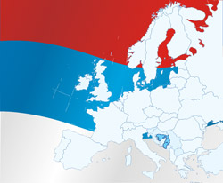
The Republic of Srpska is situated at the meeting point of two large natural-geographic and social-economic regional wholes - Pannonian and Mediterranean. In transport - geographic terms, such position of the Republic of Srpska has special importance, since a vital communication links are passing through its territory. This is primarily related to the Mediterranean direction which, with mutually linked river valleys of Bosna and Neretva, and by intercepting the Dinara mountain complex, colligates Central European and Mediterranean macro-region. The parallel direction that links Republic of Srpska with the Central Balkans and the Western European region is of the equal importance. In that regard, it is necessary to emphasize the significance of Republic of Srpska's approach to the Sava river, which links it with the European transport route Rein- Main- Danube. Therefore, the area of the Republic of Srpska is the conjunction of the Pannonian and the Adriatic basin, from one side, and the Western Europe and the Central Balkans from the other side.
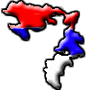
 The total length of the borders of the Republic of Srpska is app. 2170 km, out of which the inter-entity boundary with the Federation of Bosnia and Herzegovina accounting for 1080 kilometers. If the territory of the Republic of Srpska were in the shape of a circle, the total length of its borders would be only 561 kilometers. This means that the coefficient of the border indentation is 3.6, which is rare in the world.
Natural characteristics of the Republic of Srpska are very complex, because it belongs to several natural geographic wholes and its geomorphologic evolution.
The geomorphology of the territory of the Republic of Srpska abounds in different forms. In the northern peri-Pannonian part, the hilly terrain, composed of Cenozoic deposits, gradually descends to the flat land with alluvial tablelands and fluvial terraces, which is the most fertile area in the Republic of Srpska. There are only a few scattered mountains - Kozara, Prosara, Motajica, Vucijak and Trebovac, and the northeastern flanks of the mountain Majevica. In the southern direction the flat land turns into the hilly terrain and then into the mountainous area which covers the largest portion of the territory of the Republic of Srpska.


